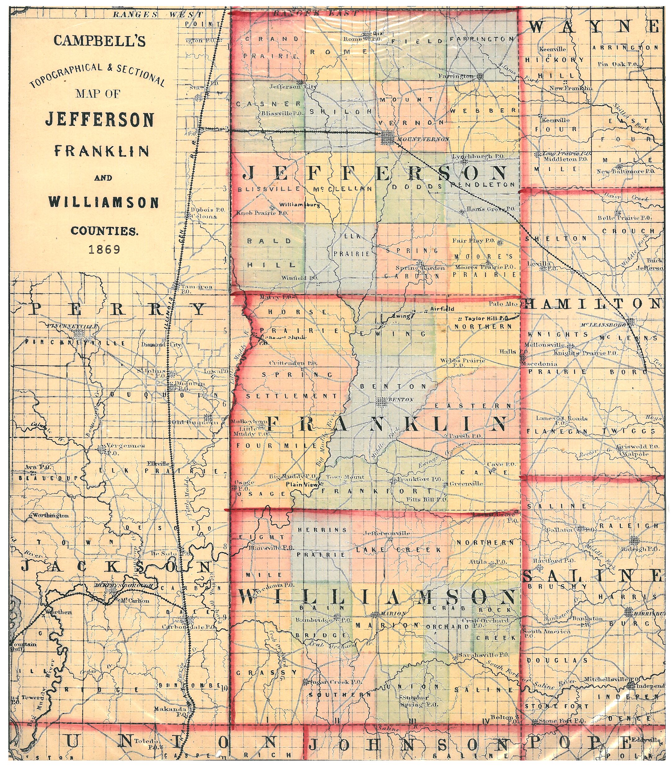
Comparison of this newly available 1869 map indicates a change from the 1876 map on the west side of the county. In this map, Grassy occupies not only its position in 1876 but also occupies the space of the 1876 Eight Mile Township. Eight Mile Township in this map occupies the space where Western Township will be in the 1876 map that later became Blairsville Township.